A Route as a Destination Design principles & guidelines for Leppävaara Sports Paths
Overview
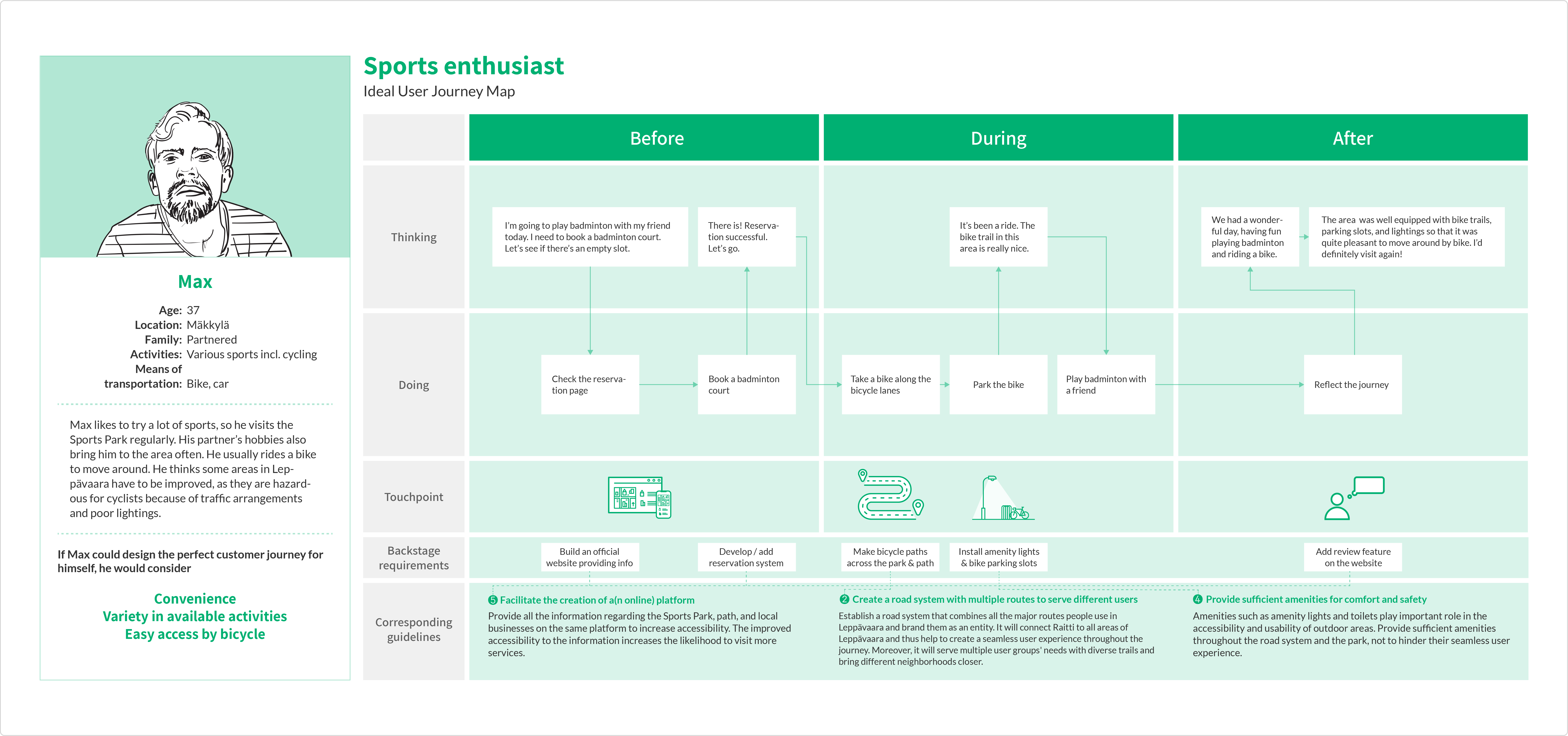
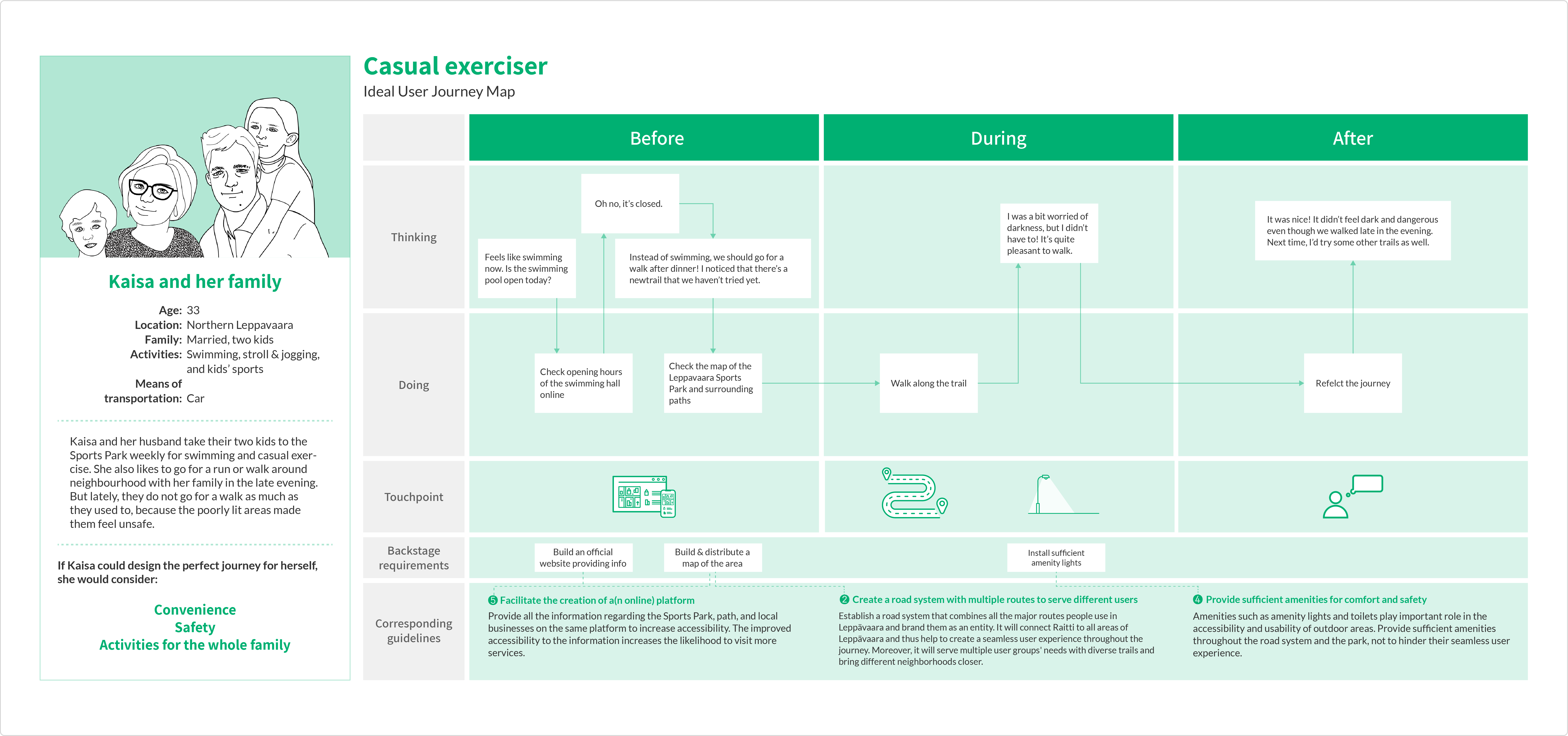
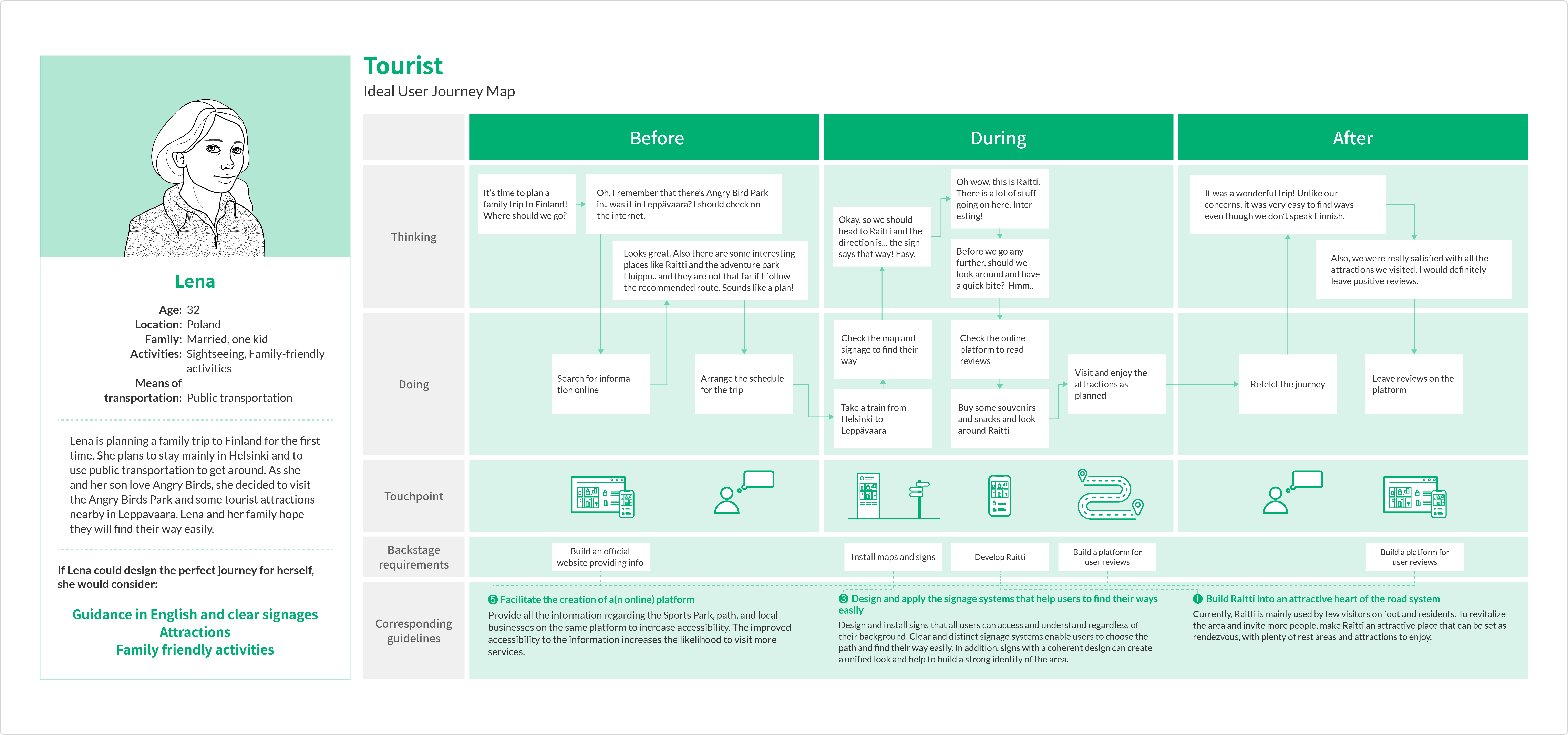
The city of Espoo planned to develop a promenade —namely, Sports Path— that would lead Leppävaara Sports Park visitors from the train station to the park. The initial brief was to propose functional and commercial concepts of the Sports Path that would support the entity consisted of the park and the paths. During the research, however, we found that the park and paths are not perceived as one entity, as there is no visible connection between the park and paths. We reframed the design brief as "design principles and guidelines for the park and path(s) development" that help the Sports Park and paths to be perceived as an entity and to serve multiple users' needs. The principles and guidelines were developed based on the ideal user journey maps created from four user types' perspectives.
-
Date :
Feb - Mar 2018
-
Client :
City of Espoo & Aalto Univ. (Espoo, Finland)
-
Team :
Soyeon Park, Lea Randebrock, Jaakko Raami, Jemina Härkälä, Sannimari Honkanen, Yiching Tu
-
Role :
Research planning and practice, research analysis, concept generation, and formulating guidelines
INTRODUCTION
Challenge
Leppävaara sports park, which is placed in the heart of Leppävaara, is a hub of activity that has approximately two million visitors per year. The city wanted to bring park visitors through one main fairway, the Sports Path. However, as the sports path was not perceivable enough, the pedestrian traffic was scattered. The city was planning to renovate the route to encourage meetings between people, bring tourists into Leppävaara, and bring more revenue for local businesses. The initial goal of the project was as follows :
-
Develop and propose functional and commercial concepts of the sports path that support the entity formed by the Sports Path and the Sports Park.
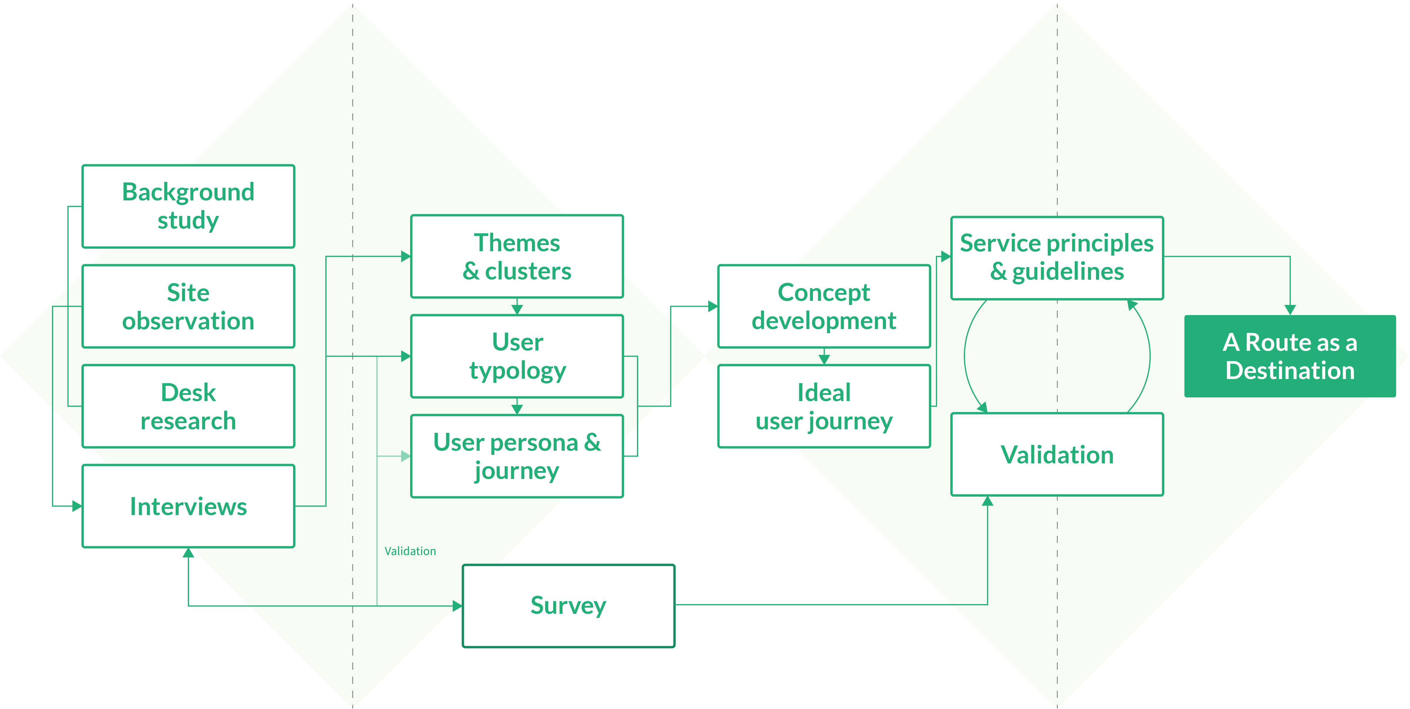
Process
Background Image: "Leppävaaranraitti pedestrian street in Leppävaara" by Skelanard, used under CC BY 4.0 / Tinted and blurred from original
DISCOVER
Understanding the Context
After the project kick-off, we had a meeting with the client where we could have a deeper understanding of the project background. The team also visited Leppävaara to observe the area, including the park and the path. In addition, we conducted desk research to get overall information about the area and the sports park and to search for examples to benchmark. As a result, we could grasp the current state of the Sports Path and identify the relevant stakeholders.
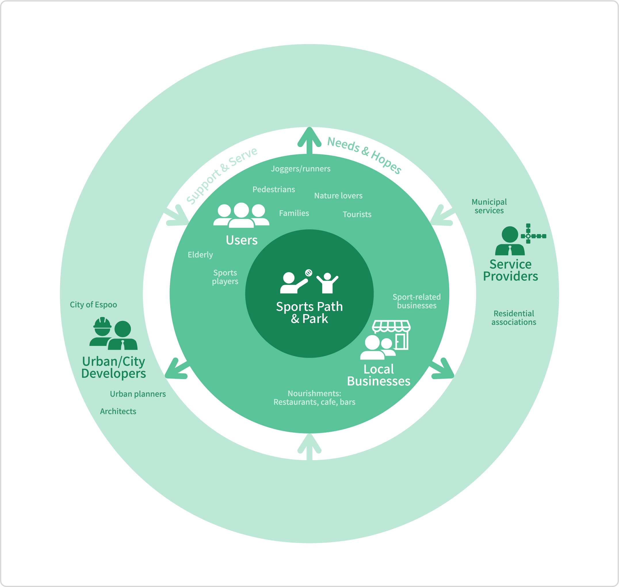
Stakeholders map
What we found after visiting the Sports Path
Empathising with Stakeholders
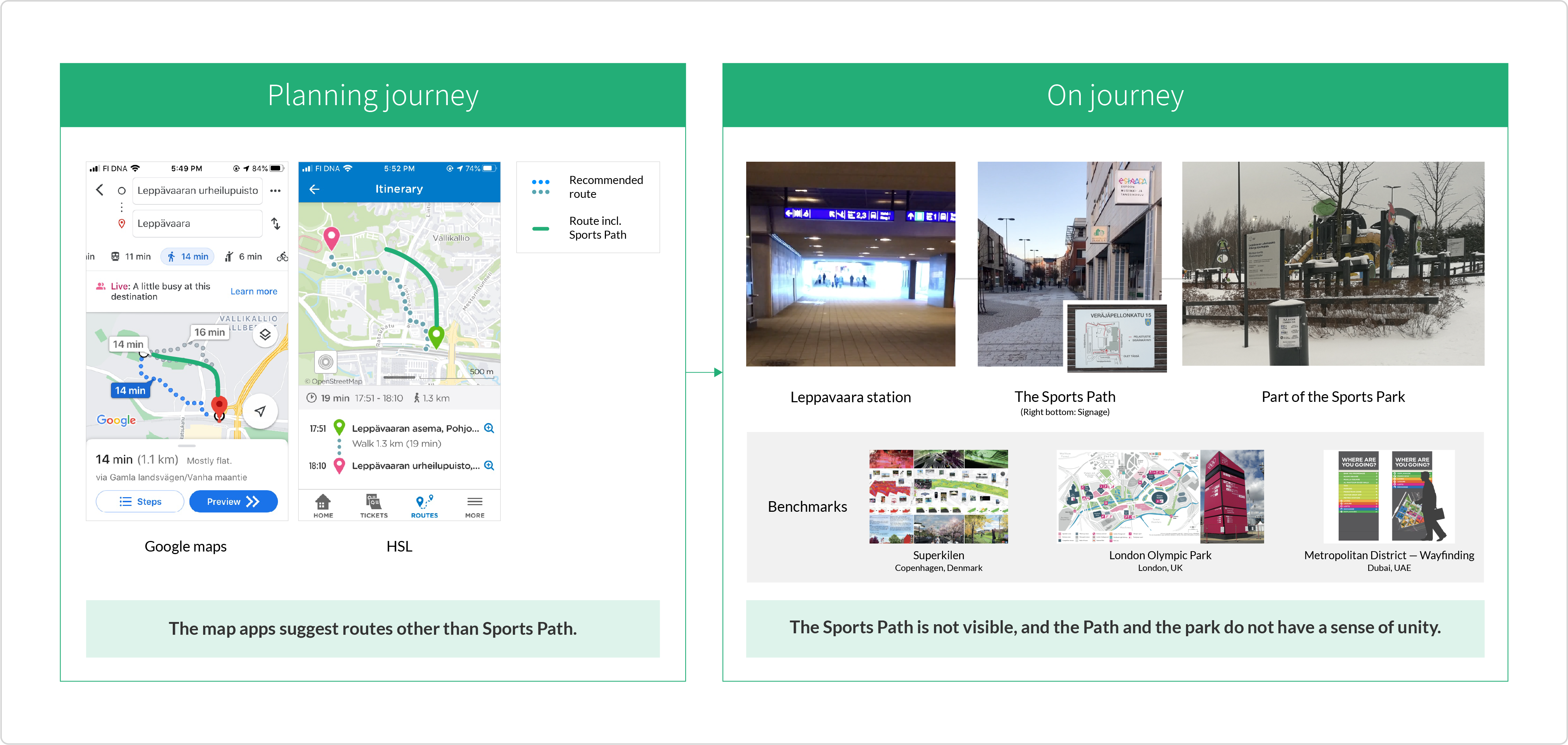
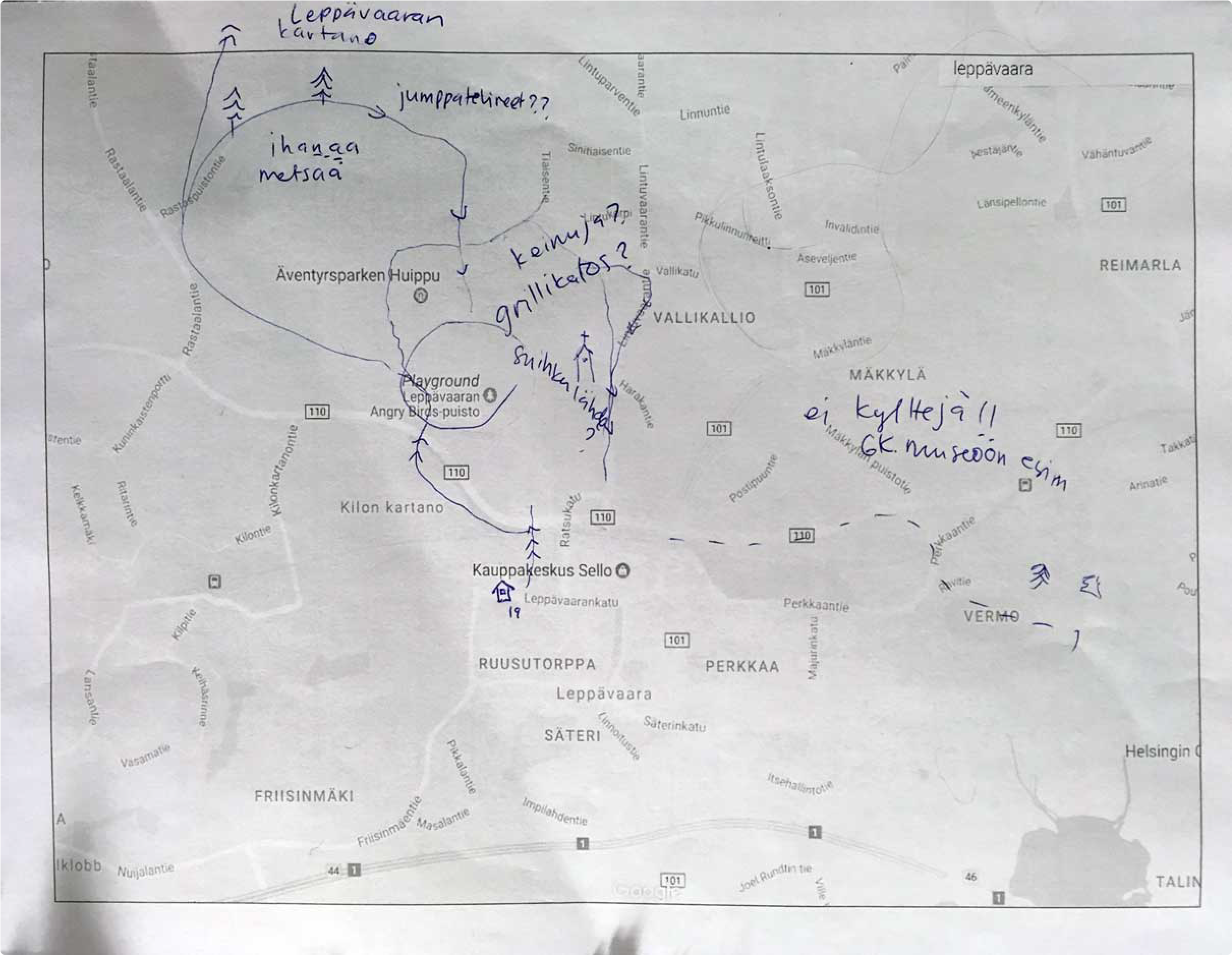
To understand how the park and path users and local business owners think of Leppävaara Sports Park and the Path, we conducted interviews with nine users and three local business owners. For the users, we asked them to describe their usual journey and mark the route on the paper map we prepared.
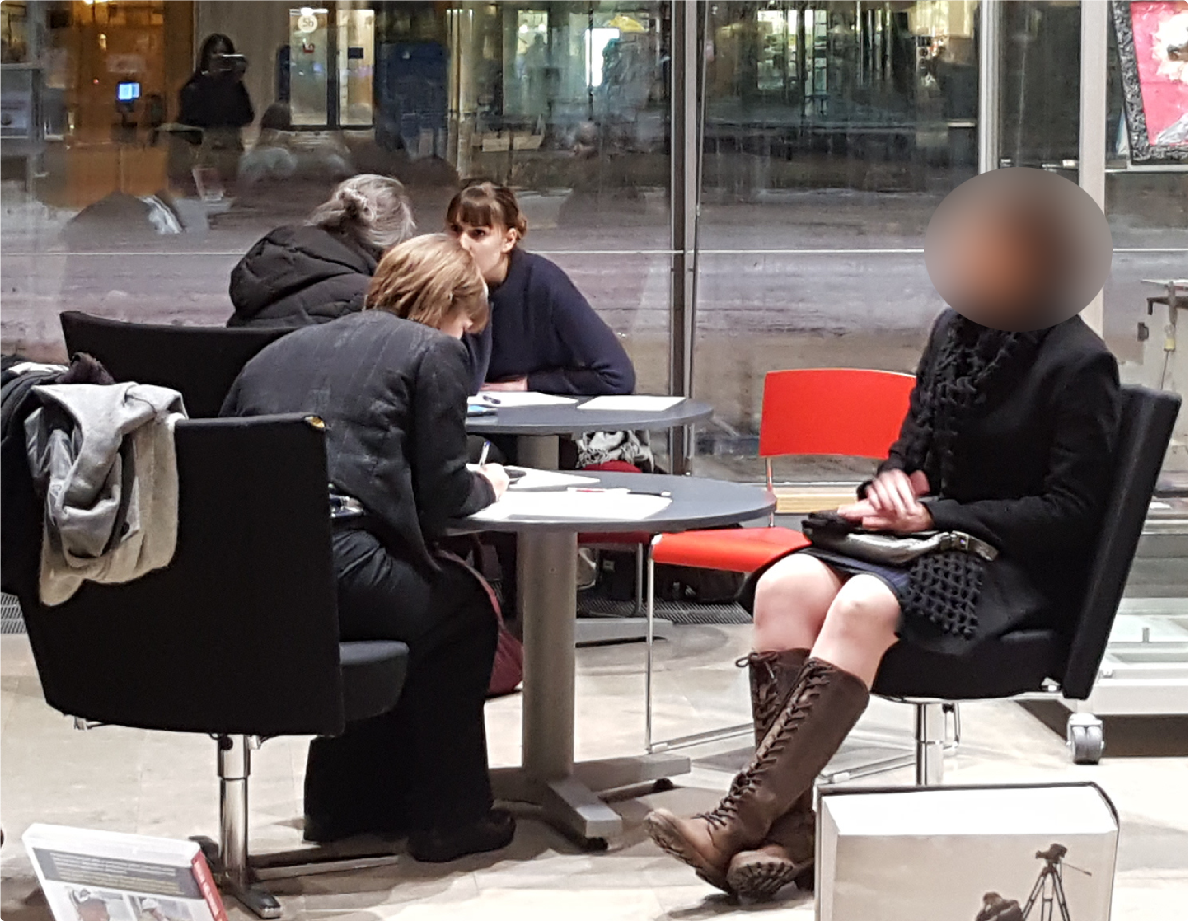
Interview with users
One of interviewees' main routes marked on the map
DEFINE
Analyzing & Synthesizing the Research Data
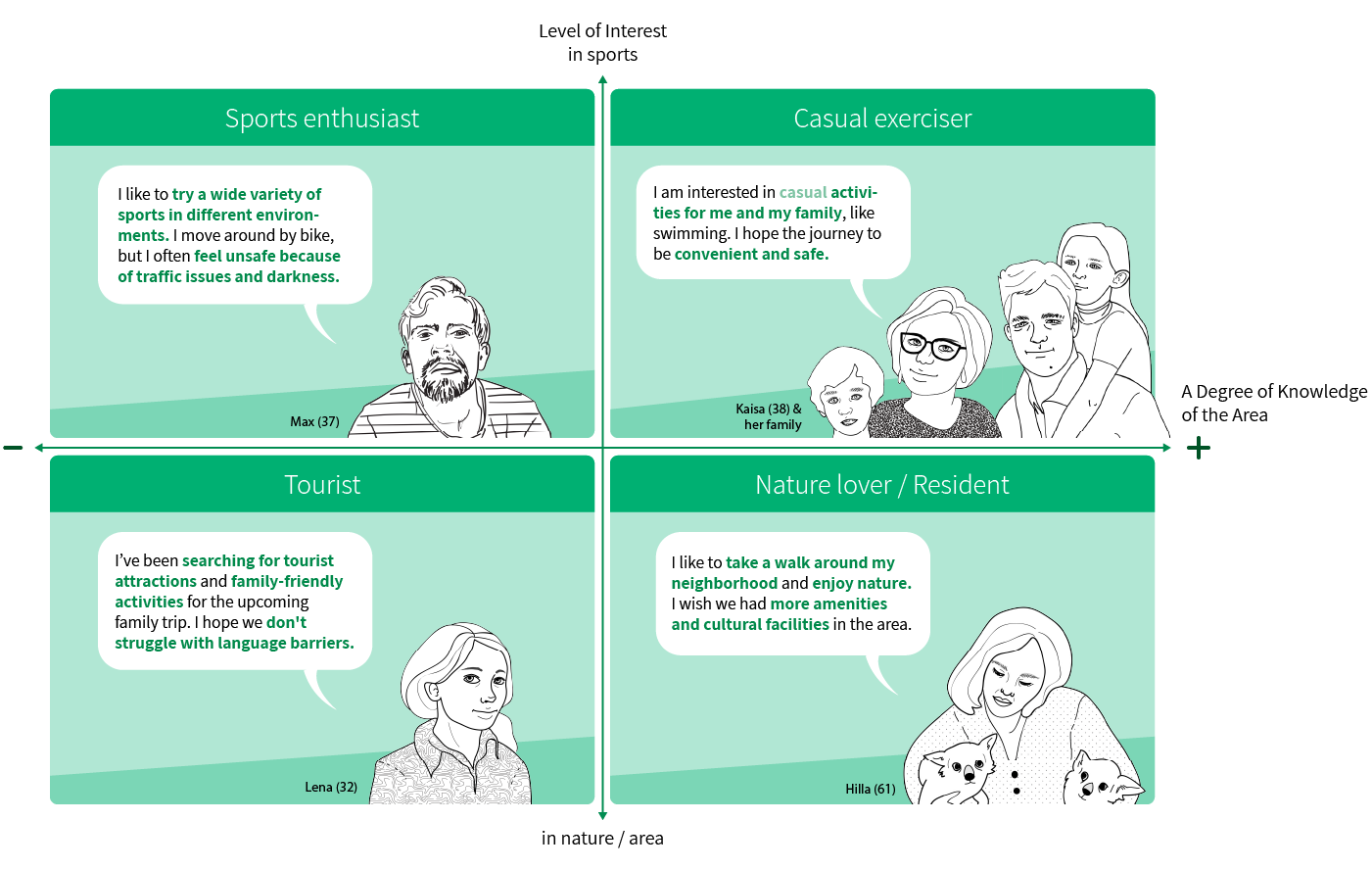
For the analysis, we created an affinity map with the pieces of data collected during the previous phase. As a result of affinity diagramming, we defined four different user types and personas of each type and formed insights.
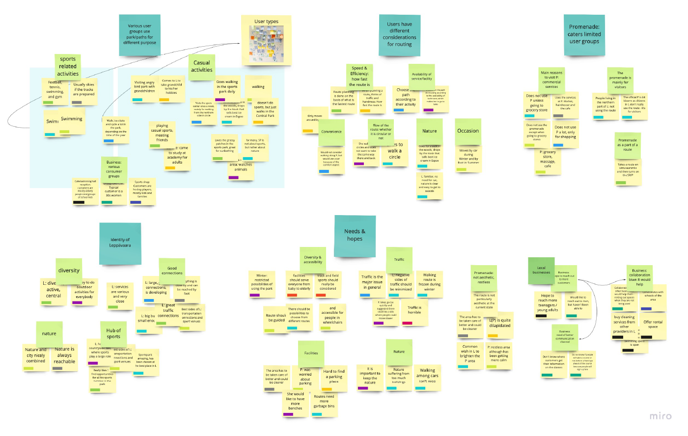
Affinity map
User types and personas
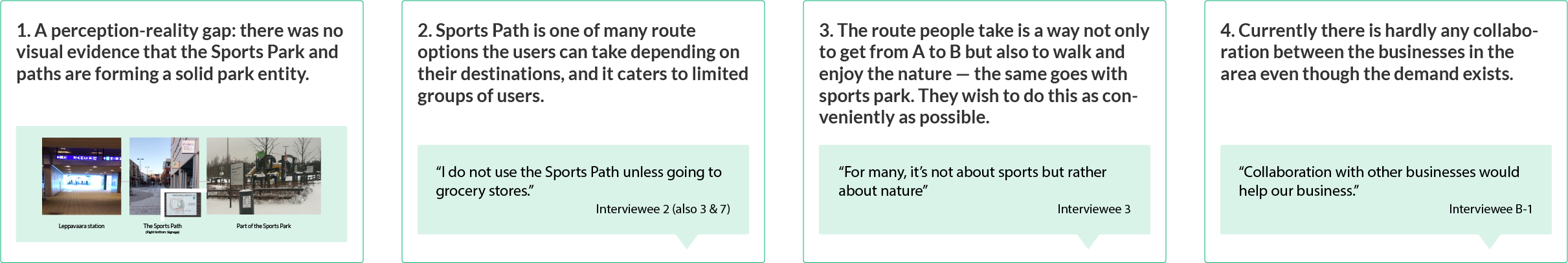
4 Key insights
Reframing the brief
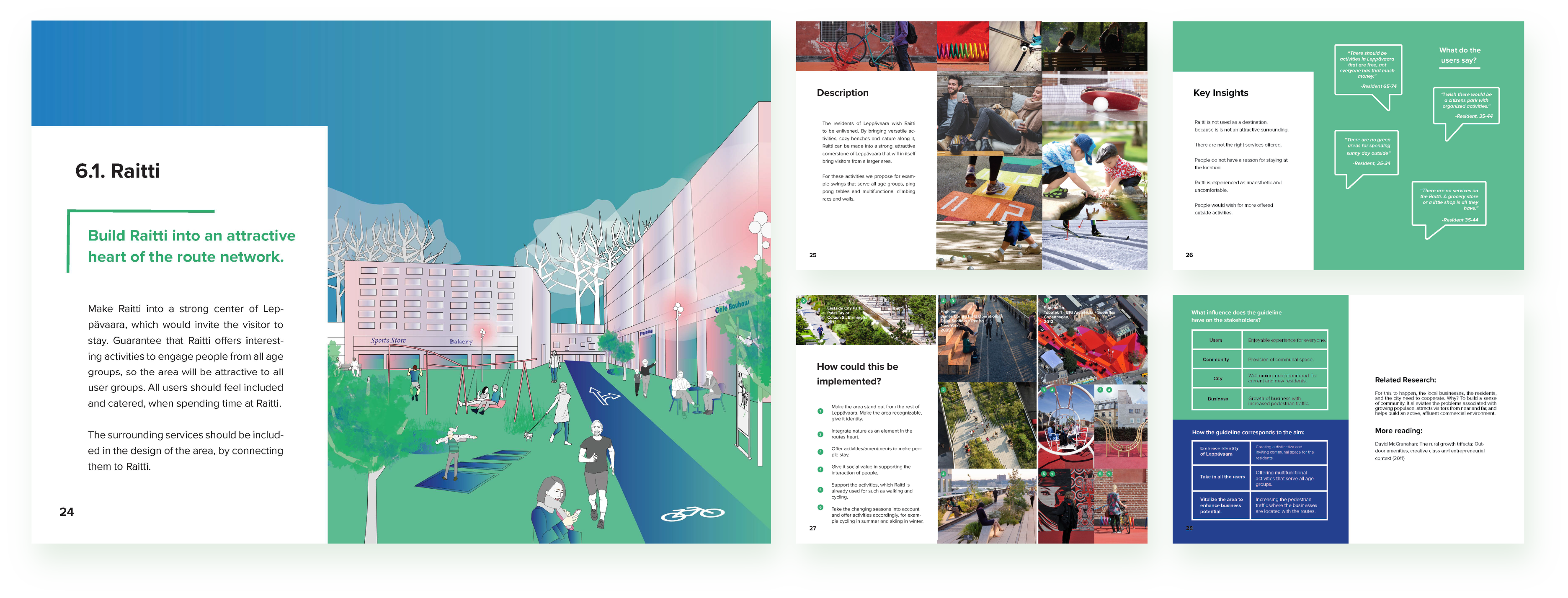
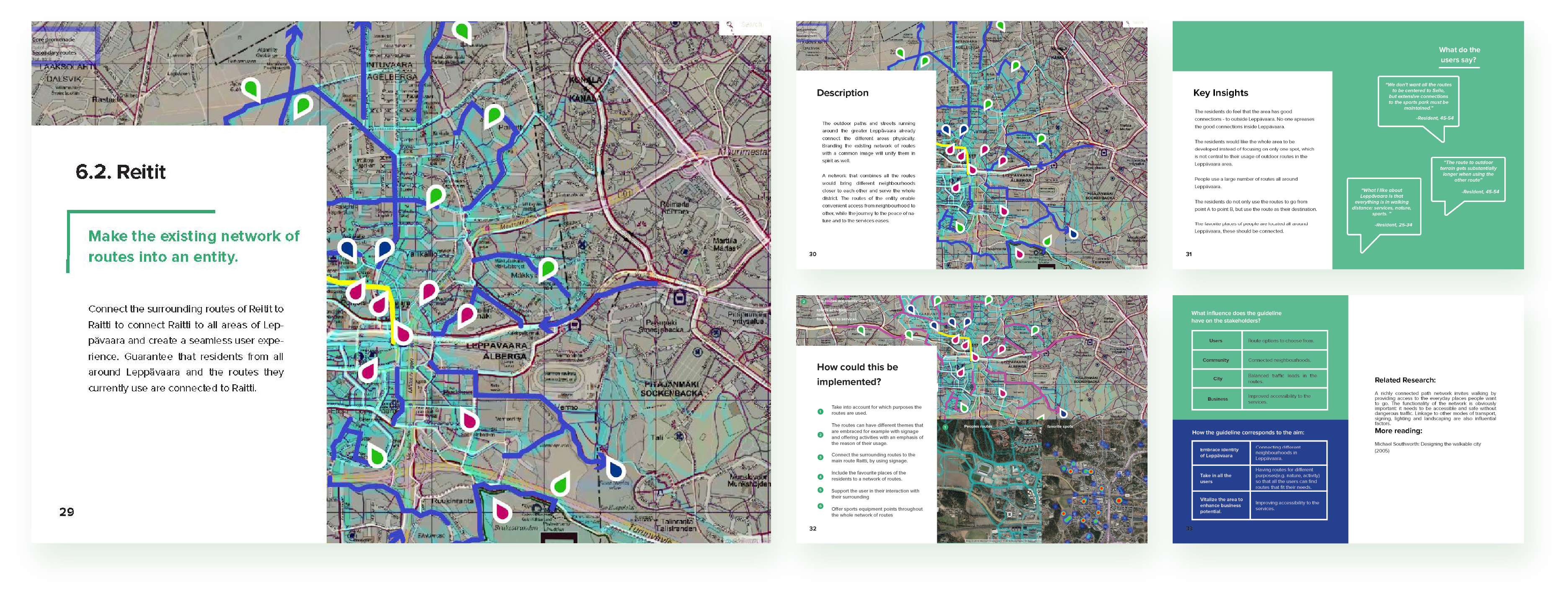
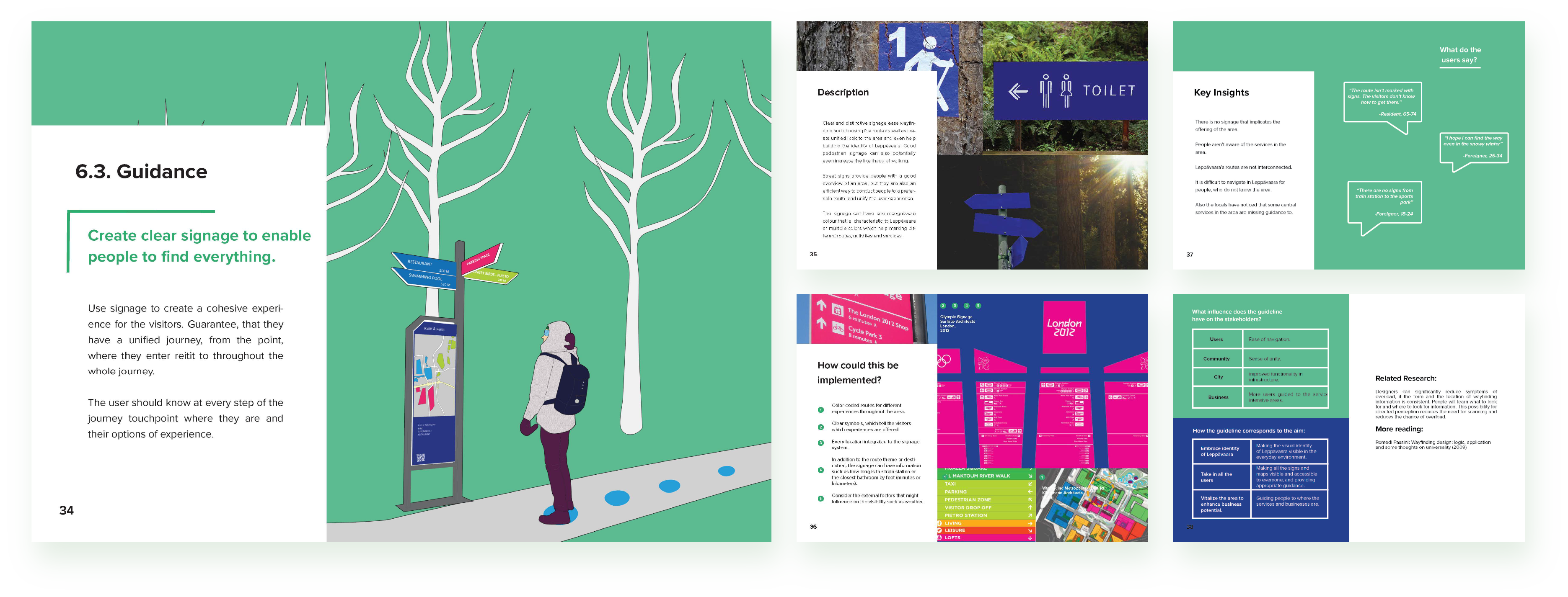
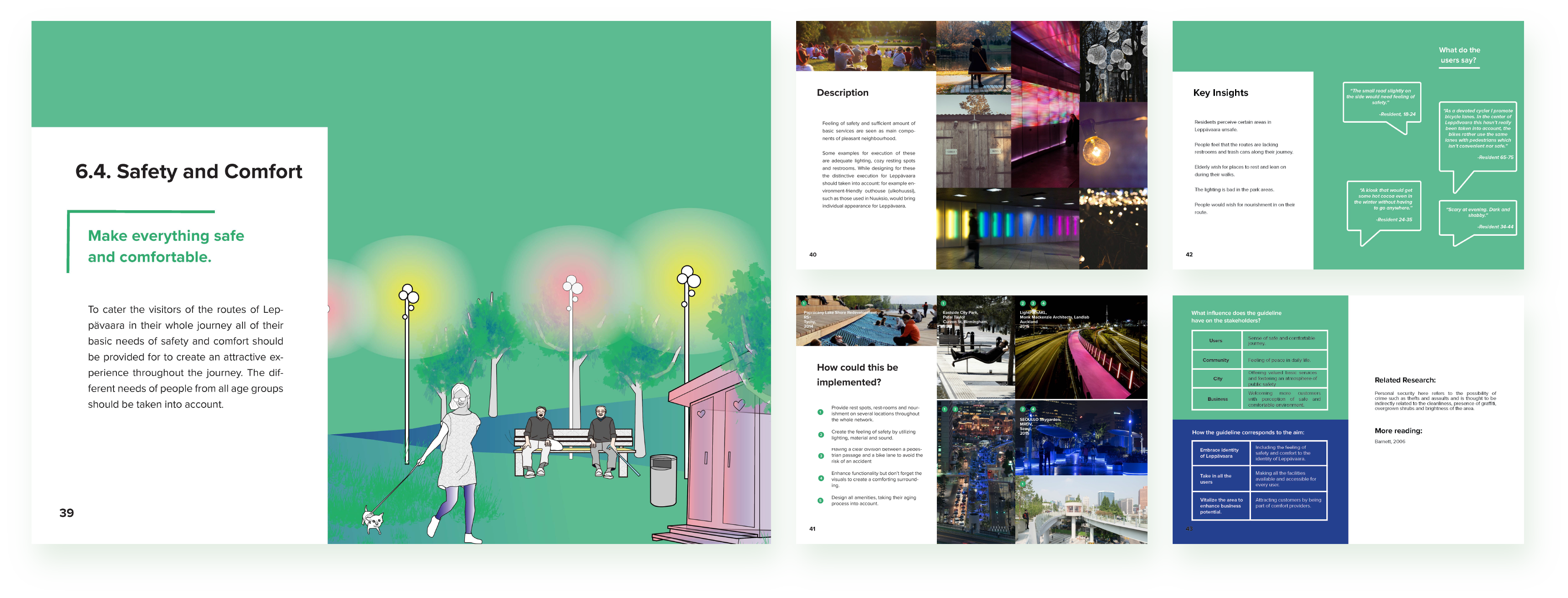
Combining the research findings, we decided to take a more holistic approach on the Leppävaara Sports Park and the path development and reframed the brief as "creating a set of design guidelines for the park and path(s) development" to achieve the following aims:

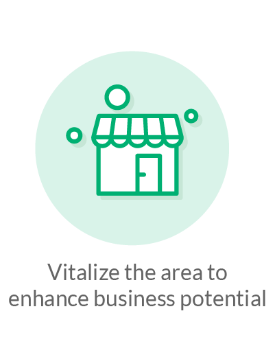
Goals to be achieved
DEVELOP
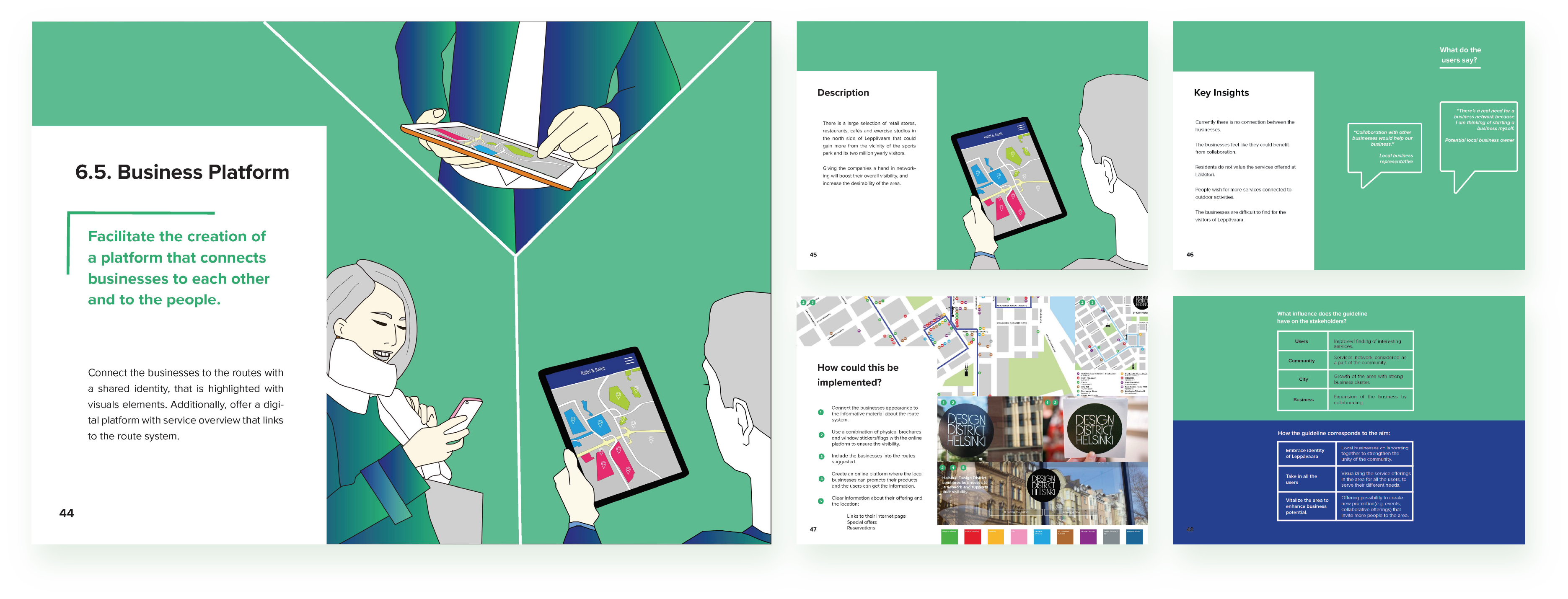
Developing Principles & Guidelines
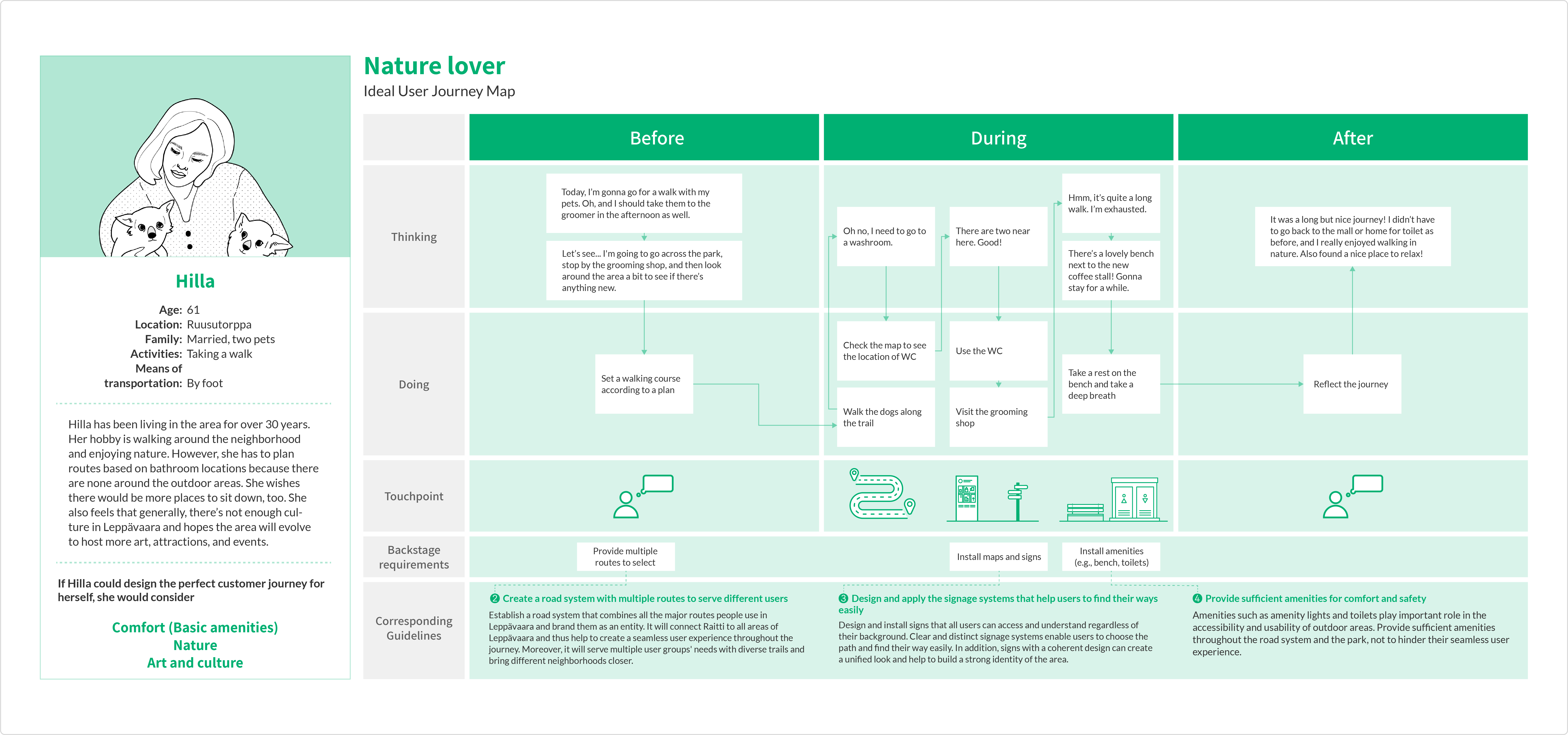
To develop guidelines, we created ideal user journey maps for each persona and identified several backstage requirements to support these journeys. As a result, five major design guidelines were developed by combining all backstage requirements identified during the ideal user journey mapping.
Validating the Outcome
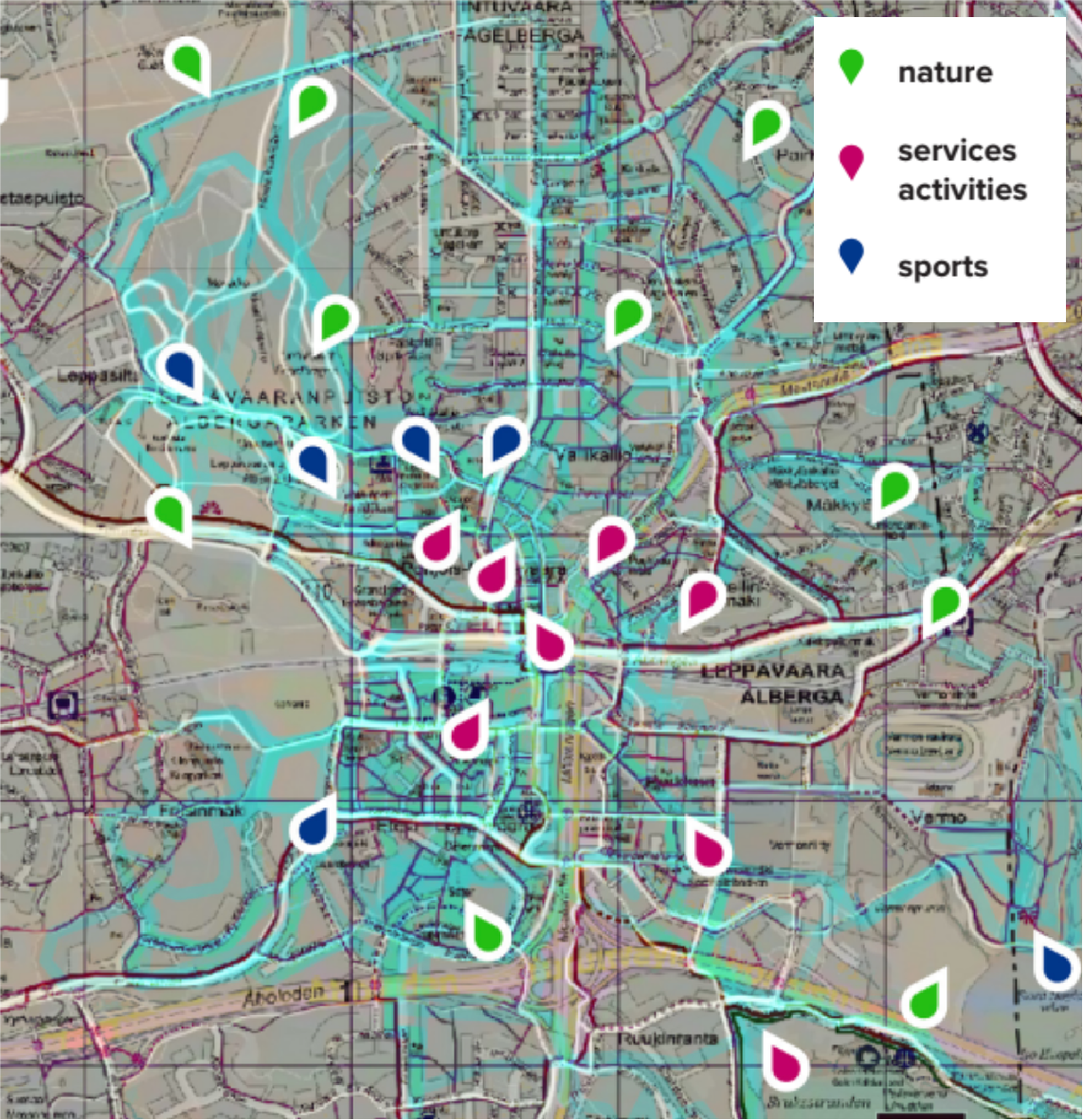
To validate the content of principles and guidelines, we conducted an additional map-based survey on how different park and path users think of the path, park, and the Leppävaara area. The survey results were used to validate and refine the outcome, and also as additional references.
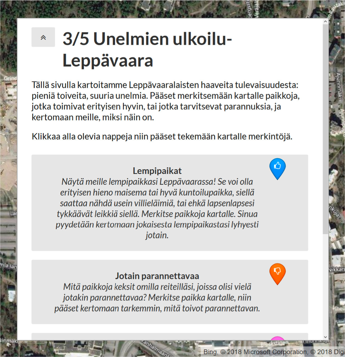
Maptionnaire survey
A map showing part of research data
DELIVER
Final Outcome
We delivered a project report that includes design principles and guidelines with research findings and reference examples.